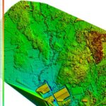
Remote sensing is the acquisition of information about an object or phenomenon without making physical contact with the object and thus in contrast to on-site observation. Remote sensing is used in numerous fields, including geography, land surveying and most Earth Science disciplines (for example, hydrology, ecology, oceanography, glaciology, geology); it also has military, intelligence, commercial, economic, planning, and humanitarian applications. the term “remote sensing” generally refers to the use of satellite- or aircraft-based sensor technologies to detect and classify objects on Earth, including on the surface and in the atmosphere and oceans, based on propagated signals. The information gathered by remote sensing can be used to create maps and models of the Earth’s surface, which can be used to study and analyze various phenomena. Photogrammetry is the science and technology of obtaining reliable information about physical objects and the environment through the process of recording, measuring, and interpreting photographic images and patterns of electromagnetic radiant imagery and other phenomena.
We are also providing following services in the field of Remote Sensing and Photogrammetry Mapping.
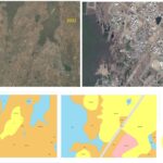
Full colour orthophoto production.
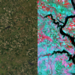
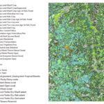
High resolution satellite image processing and interpretation.