Our Services
Land Surveying/ Topographic Surveying:
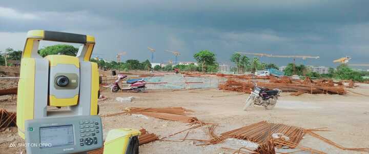
Our experienced team utilizes advanced surveying techniques to accurately measure and map land parcels, capturing essential data such as boundaries, easements, and land features. Whether it’s for property development, infrastructure projects, or land management, our land surveying services provide the foundation for successful planning and decision-making.
Topographic Surveying: We excel in capturing detailed information about the natural and man-made features of a landscape, including elevation, contours, vegetation, and infrastructure. Our topographic surveys are essential for engineering design, environmental assessment, and resource planning, enabling clients to navigate complex terrain with confidence.

GIS (Geographical Information System) Mapping
Leveraging the power of Geographic Information Systems (GIS), we create interactive maps and spatial databases that enable clients to visualize, analyze, and interpret geographic data. From urban planning and transportation modelling to environmental monitoring and emergency response, our GIS solutions support a wide range of applications, providing valuable insights for decision-makers.
Remote Sensing Mapping
Remote Sensing Mapping: With one of the most experienced Remote Sensing expert teams, we provide clients with result-oriented solutions in data provision, developing and implementing spatial data for project applications and effective management. We also Services provided include processing of raw satellite images, image rectification, change detection, and analysis from various high and low resolution satellite imageries like Quic bird, Landsat, cartosat, Liss IV etc and for specific applications.
Aerial Mapping: Using state-of-the-art drone technology and photogrammetry techniques, we capture high-resolution aerial imagery and create detailed maps and 3D models of landscapes, infrastructure, and construction sites. Our aerial mapping services offer a cost-effective and efficient way to gather accurate geospatial data, providing valuable insights for planning, monitoring, and decision-making.