Surveys help you answer a range of why’s and how’s!
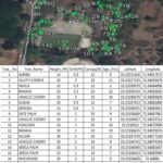
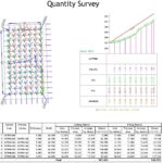
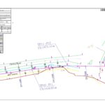
Surveying is the detailed study or inspection, as by gathering information through observations, measurements, Instruments, questionnaires, and data analysis. This data could include maps, geographical information, feasibility report, digital database, or any other kind. This data can be used for many purposes like mapping, site selection, urban planning, decision making, construction planning, engineering aspect, transportation, utility etc.
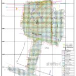
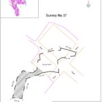
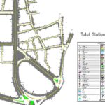
Surveying or Land surveying is the technique, profession, art, and science of determining the terrestrial two-dimensional or three-dimensional positions of points and the distances and angles between them. These points are usually on the surface of the Earth, and they are often used to make maps and database. Surveying plays the major role in geographical aspects of mapping.
We provide following services as per customer requirements using latest technology, best surveying techniques and instruments.